Client: Environmental Protection Agency
Project summary
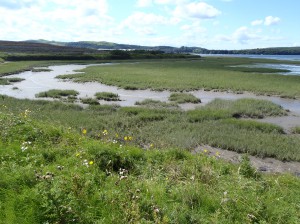
This desk-based project, through collation and analysis of available data on Irish saltmarshes, developed and applied a tool for ecological status assessment of the angiosperm Biological Quality Element in coastal and transitional waters for the Water Framework Directive (WFD). The tool was developed following assessment of similar tools used by other Member States in the Northeast Atlantic Geographical Intercalibration Group. Potential metrics for inclusion in the tool were investigated addressing the required aspects of abundance, composition and disturbance sensitive taxa.
The final version of the tool from SMAATIE comprises metrics examining saltmarsh extent, the number of vegetation zones present, the relative proportion of these zones, the abundance of the non-native invasive plant Spartina anglica and the frequency of salt-tolerant native species. The tool was tested using available data for a selection of water bodies. Of the forty water bodies assessed, four (10.0%) had a BQE status of High, fifteen (37.5%) were Good, eighteen (45.0%) were Moderate and three (7.5%) were Poor. The main reason for water bodies failing to make Good status was scoring poorly under the area metric due to widespread land reclamation.
To assist in the tool development, a vegetation classification for Irish saltmarshes was developed by collating and analysing existing data from over 3,400 quantitative vegetation samples using multivariate statistics. Six classes of vegetation were defined describing the pioneer zone, lower marsh, middle marsh, upper marsh, upper transitional zone, and brackish swamps.
Guidance and recommendations were made on the timing and methodology of data collection for ongoing monitoring purposes in order to ensure the State is WFD-compliant in this regard. The SMAATIE project identified a number of knowledge gaps which limited the development of the tool and its application, and recommendations were made to address these. These knowledge gaps included the pressure-indicator relationships and ecosystem services/functions of Irish saltmarshes. A need for improved knowledge in these areas has been identified to fulfil Ireland’s obligations under the WFD and has led to the implementation of the SAMFHIRES project.
Project outputs
The following outputs are available from the EPA SAFER website here:
- Fully-detailed End of Project report
- Practitioner’s Manual which synthesises the main report
- GIS outputs in ESRI shapefile format
- Ecological Quality Ratio (EQR) calculator in Excel format
- EQR data for the 40 water bodies assessed
- Pressure data in Excel format
Slides from a presentation on the project made at the CIEEM Irish Section Conference in 2014 can be viewed here.
