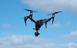
iHabiMap is an EPA-funded large-scale project that is running from 2019 to 2023. It aims to develop analytical approaches to determine if UAV imagery and satellite data in combination with machine learning can effectively map, assess and monitor a range of semi-natural and Annex I habitats.
Three broad habitat types, together with their associated Annex I habitats, will be assessed during the project: upland habitats, lowland grassland habitats and coastal habitats, focusing particularly on sand dunes.
The iHabiMap project is a multi-disciplinary collaboration between DCU, BEC Consultants and Orbas, bringing together experts in earth observation, ecological assessment and machine learning.
For updates on project progress follow us on Twitter.

